
The early 2026 Atlantic hurricane season forecast points toward a near-average to somewhat below-average year, mainly because El Niño is expected to build and increase hostile wind shear across the Atlantic. That sounds better than a hyperactive forecast, but it does not make the coast safe.
Quick 2026 Forecast Snapshot
The Atlantic hurricane season officially runs from June 1 through November 30, with the busiest part of the season usually falling between August and October. NOAA’s Climate Prediction Center lists the 1991 to 2020 average Atlantic season as 14.4 named storms, 7.2 hurricanes, 3.2 major hurricanes, and an average ACE near 122.[9]
Most of the current 2026 outlooks are clustered a little below or close to that modern average. Colorado State University expects 13 named storms, 6 hurricanes, 2 major hurricanes, and an ACE of 90.[1] North Carolina State University expects 12 to 15 named storms, 6 to 9 hurricanes, and 2 to 3 major hurricanes.[2] AccuWeather expects 11 to 16 named storms, 4 to 7 hurricanes, and 2 to 4 major hurricanes, with 3 to 5 direct U.S. impacts.[3]
Core range across the main forecast cluster.
Most outlooks sit slightly below or near average.
Category 3 or stronger storms remain possible.
Expected to raise wind shear across the Atlantic.
Bottom line: The 2026 Atlantic hurricane season does not currently look like one of the most extreme recent years. But a below-average forecast is not a protection plan. A single landfalling hurricane can still cause catastrophic damage, long outages, storm surge, flooding, and weeks of cleanup.
What the Major 2026 Hurricane Forecasts Are Saying
Seasonal hurricane forecasts look at the whole Atlantic basin, not one city, beach, or county. That basin includes the Atlantic Ocean, Caribbean Sea, and Gulf of Mexico. So when a forecast says “near average,” it is talking about total seasonal activity across a huge area.
That is why the exact numbers matter less than the pattern behind them. Right now, most forecast groups see El Niño developing during the heart of the season. El Niño tends to increase vertical wind shear over the Atlantic and Caribbean, which can tear apart developing storms or keep them from strengthening. At the same time, forecasters are still watching warm water in the Gulf, Caribbean, and western Atlantic because warm water can fuel quick intensification if a storm finds a favorable window.
| Source | Release Date | Named Storms | Hurricanes | Major Hurricanes | ACE | Main Reasoning | Impact Notes |
|---|---|---|---|---|---|---|---|
| Colorado State University Academic forecast |
April 9, 2026 | 13 | 6 | 2 | 90 | Somewhat below-normal season. Weak La Niña is expected to transition toward El Niño, likely increasing Atlantic wind shear.[1] | 32% chance of at least one major hurricane landfall somewhere on the U.S. coastline.[10] |
| North Carolina State University Academic forecast |
April 22, 2026 | 12 to 15 | 6 to 9 | 2 to 3 | Not listed | Near recent averages, based on historical storm behavior, intensity, sea-surface temperatures, and broader weather patterns.[2] | Gulf of Mexico could see 2 to 5 named storms and 1 to 2 hurricanes.[2] |
| AccuWeather Private expert forecast |
March 25, updated April 9, 2026 | 11 to 16 | 4 to 7 | 2 to 4 | Not listed | Developing El Niño may hold the season near or below historical averages, but very warm water raises rapid-intensification concerns.[3] | 3 to 5 direct U.S. impacts, with higher concern near the central and eastern Gulf Coast, Carolinas, and parts of coastal Virginia.[3] |
| The Weather Company / Atmospheric G2 Private expert forecast |
April 16, 2026 | 12 | 6 | 2 | Not publicly listed | Relatively quiet season. El Niño is expected to increase Atlantic wind shear and sinking air, making development harder.[4] | No public landfall probability listed in the outlook article. |
| University of Arizona High-side outlier |
April 3, 2026 | 20 | 9 | 4 | 155 | Above-average forecast using a machine-learning method informed by ECMWF seasonal data and Atlantic sea-surface temperature signals.[5] | No public U.S. landfall probability listed. |
| University of Pennsylvania Mann Research Group Academic forecast |
April 2026 | 10 best estimate, range 7 to 13 | Not listed | Not listed | Not listed | Statistical model using Main Development Region SST anomalies, projected positive ENSO conditions, and climatological North Atlantic Oscillation assumptions.[6] | Low-side forecast for named tropical cyclones only. |
| NOAA Climate Prediction Center Official ENSO guidance |
April 9, 2026 | No seasonal storm-count forecast yet | No seasonal storm-count forecast yet | No seasonal storm-count forecast yet | Not applicable | ENSO-neutral is favored through April to June, with El Niño likely to emerge in May to July and persist through at least late 2026.[7] | Climate driver source, not a landfall forecast. |
| WMO and ECMWF Global climate guidance |
April 10 to April 24, 2026 | No Atlantic storm-count forecast | No Atlantic storm-count forecast | No Atlantic storm-count forecast | Not applicable | Both point toward a likely El Niño, while also noting uncertainty tied to the spring predictability barrier.[8][11] | Supports the broader El Niño signal behind several Atlantic outlooks. |
Colorado State University
Academic forecast- Named storms
- 13
- Hurricanes
- 6
- Major hurricanes
- 2
- ACE
- 90
Somewhat below-normal season, mainly tied to a likely transition toward El Niño and stronger Atlantic wind shear.[1]
Impact note: 32% chance of at least one major hurricane landfall somewhere on the U.S. coastline.[10]
North Carolina State University
Academic forecast- Named storms
- 12 to 15
- Hurricanes
- 6 to 9
- Major hurricanes
- 2 to 3
- ACE
- Not listed
Near recent averages, based on historical storm behavior, intensity, sea-surface temperatures, and broader weather patterns.[2]
Impact note: Gulf of Mexico could see 2 to 5 named storms and 1 to 2 hurricanes.[2]
AccuWeather
Private expert forecast- Named storms
- 11 to 16
- Hurricanes
- 4 to 7
- Major hurricanes
- 2 to 4
- ACE
- Not listed
Developing El Niño may hold the season near or below historical averages, but very warm water still raises rapid-intensification concerns.[3]
Impact note: 3 to 5 direct U.S. impacts, with higher concern near the central and eastern Gulf Coast, Carolinas, and coastal Virginia.[3]
The Weather Company / Atmospheric G2
Private expert forecast- Named storms
- 12
- Hurricanes
- 6
- Major hurricanes
- 2
- ACE
- Not public
Relatively quiet season. El Niño is expected to increase Atlantic wind shear and sinking air, making development harder.[4]
Impact note: No public landfall probability listed in the outlook article.
University of Arizona
High-side outlier- Named storms
- 20
- Hurricanes
- 9
- Major hurricanes
- 4
- ACE
- 155
Above-average forecast using a machine-learning method informed by ECMWF seasonal data and Atlantic sea-surface temperature signals.[5]
Impact note: No public U.S. landfall probability listed.
University of Pennsylvania Mann Research Group
Academic forecast- Named storms
- 10 estimate
- Range
- 7 to 13
- Hurricanes
- Not listed
- ACE
- Not listed
Statistical forecast using Main Development Region SST anomalies, projected positive ENSO conditions, and climatological NAO assumptions.[6]
Impact note: Low-side forecast for named tropical cyclones only.
NOAA Climate Prediction Center
Official ENSO guidance- Storm count
- Not released
- Main signal
- El Niño Watch
ENSO-neutral is favored through April to June, with El Niño likely to emerge in May to July and persist through at least late 2026.[7]
Impact note: Climate driver source, not a landfall forecast.
WMO and ECMWF
Global climate guidance- Storm count
- Not issued
- Main signal
- Likely El Niño
Both point toward a likely El Niño, while noting uncertainty tied to the spring predictability barrier.[8][11]
Impact note: Supports the broader El Niño signal behind several Atlantic outlooks.
The widest public range runs from roughly 7 to 20 named storms, depending on how much weight each model places on El Niño versus Atlantic warmth. That spread looks large, but the center of gravity is clearer: most major outlooks sit close to 12 to 15 named storms, with fewer major hurricanes than a very active La Niña-style year.
The Main Weather Drivers Behind the 2026 Outlook
El Niño is the biggest suppressing signal
NOAA CPC issued a Final La Niña Advisory and El Niño Watch on April 9, 2026. The agency said ENSO-neutral conditions are present and favored through April to June, then El Niño is likely to emerge during May to July and persist through at least the end of 2026.[7]
For Atlantic hurricanes, that matters because El Niño often increases upper-level winds over the tropical Atlantic and Caribbean. Those winds create vertical wind shear. A healthy tropical cyclone needs a vertically stacked circulation. Strong shear tilts the storm, disrupts thunderstorms near the center, and can stop tropical waves from becoming hurricanes.
WMO also reports a clear shift toward likely El Niño development from mid-2026, while noting that spring forecasts are harder because model confidence usually improves after April.[8] ECMWF makes the same basic point: current model systems strongly support El Niño development, but they do not all agree on exactly how strong it will become.[11]
Why El Niño matters in plain English
Think of a developing hurricane like a spinning stack of plates. When wind shear gets too strong, the stack leans and starts to fall apart. El Niño does not stop every storm, but it often makes the atmosphere less friendly for storms trying to organize over the Atlantic.
Warm Atlantic water is the counterweight
The season would be easier to summarize if El Niño were the only factor. It is not. Warm water in the Atlantic, Gulf of Mexico, and Caribbean can still support dangerous storms, especially close to land. AccuWeather specifically warns that very warm water extending hundreds of feet below the surface raises concern for rapid intensification.[3]
Rapid intensification is the scenario coastal residents hate because it can shorten preparation time. A storm that looks manageable one day can become much more dangerous by the next advisory cycle if it passes over deep warm water and wind shear relaxes at the wrong time.
The western basin deserves extra attention
Colorado State University notes that sea-surface temperatures are warmer than normal in the western tropical Atlantic, while the eastern and central tropical Atlantic are not as warm.[1] That pattern matters because storms that form or strengthen closer to the Gulf, western Caribbean, Florida, or the Southeast coast may leave less time to prepare.
That is why a quieter Atlantic basin forecast can still produce a stressful local season. A long-track storm off Africa might struggle in hostile shear. A homegrown disturbance near the Gulf or western Atlantic could still organize quickly near land.
Dry air and Saharan dust may slow some storms down
Saharan dust and dry air outbreaks can suppress tropical development, especially during early and midseason. They do this by drying out the atmosphere and making it harder for thunderstorms to persist around a developing center. Still, dust is not a permanent shield. It comes and goes. One dry week does not guarantee a quiet month.
Outlier forecasts show the uncertainty
The University of Arizona forecast is the clearest high-side outlier. It calls for 20 named storms, 9 hurricanes, 4 major hurricanes, and ACE of 155, arguing that Atlantic warmth may offset much of the El Niño suppression.[5] The University of Pennsylvania forecast is lower, with a best estimate of 10 named tropical cyclones and a range from 7 to 13.[6]
Those two forecasts are useful because they show the honest uncertainty. The most likely outcome may be near average to slightly below average, but there is still room for the season to end up quieter or more active depending on how El Niño, Atlantic water temperatures, wind shear, and moisture patterns line up by August and September.
Consensus Outlook: What Homeowners Should Actually Take From This
The consensus is not “nothing to worry about.” The consensus is closer to this: 2026 looks less favorable for widespread Atlantic hurricane activity than a classic La Niña year, but the basin still has enough warm water and enough uncertainty to produce serious storms.
For planning purposes, the most useful working range is:
- Named storms: 12 to 15 is the practical core range, with wider uncertainty from about 7 to 20.
- Hurricanes: 5 to 8 is a reasonable planning range based on the main forecast cluster.
- Major hurricanes: 1 to 3 is the likely core range, though a warmer Atlantic scenario could push higher.
- ACE: CSU is below average at 90, while University of Arizona is above average at 155.[1][5]
Exact storm counts have limited value for an individual family. A season with 20 named storms can miss your area completely. A season with only a handful of storms can still deliver a devastating landfall. Hurricane Andrew in 1992 is the classic example. The season was quiet by total storm count, but Andrew was catastrophic for South Florida and Louisiana.
The more useful question is not, “Will the season be busy?” It is, “What would I regret not doing if a storm were five days away?” That answer is usually simple: check your evacuation zone, review insurance, build a basic supply kit, figure out backup power, and make sure your family has more than one way to receive alerts.
Seasonal forecasts can help set expectations. They should not decide whether you prepare.
Potential U.S. Impact Zones and Risk Scenarios
AccuWeather expects 3 to 5 direct U.S. impacts during the 2026 Atlantic hurricane season and highlights the central and eastern Gulf Coast, the Carolinas, and parts of coastal Virginia as higher-risk areas compared with some other parts of the coast.[3] Colorado State University gives the entire continental U.S. coastline a 32% chance of at least one major hurricane landfall, with a 15% chance for the East Coast including the Florida peninsula and a 20% chance for the Gulf Coast.[10]
Those probabilities are below the long-term averages, but they are not zero. That distinction matters. Below-average risk still leaves millions of people exposed along the Gulf and Atlantic coasts.
Risk scenario 1: A quick-forming Gulf storm
A stalled front or weak disturbance over the Gulf can sometimes organize near land. These storms may not have a week-long track across the open Atlantic. They can form close enough to the coast that families have only a couple of days to secure the house, buy supplies, or decide whether to leave.
This is where early preparation pays off. If water, batteries, medications, gas, pet supplies, and documents are already handled, you are not trying to do everything while everyone else is in the same checkout line.
Risk scenario 2: A storm that strengthens faster than expected
Rapid intensification remains a concern because parts of the basin are expected to hold deep warm water.[3] A storm does not need to become a Category 5 hurricane to create major problems. A strengthening Category 1 or Category 2 hurricane can still produce damaging surge, power outages, roof damage, falling trees, blocked roads, and inland flooding.
Risk scenario 3: Water damage from a weaker storm
People often focus on the Saffir-Simpson category, but the category only measures wind. It does not measure rainfall, storm size, freshwater flooding, tornadoes, or storm surge. NOAA’s National Hurricane Center warns that storm surge can be dangerous or life-threatening and can travel inland through rivers and canals.[12]
That is why a “tropical storm” can still be a serious emergency. If it stalls, drops heavy rain, pushes water into bays or canals, or knocks out power in summer heat, the real-life impact can be much worse than the category suggests.
Risk scenario 4: Power outage stress after the storm
A lot of storm pain starts after the wind stops. The house is hot. Phones are low. The refrigerator is warming. Gas stations are packed. Internet is spotty. A relative needs a medical device charged. That is why backup power planning belongs inside a hurricane forecast article, not just a gear guide.
If you are not sure what size power setup you need, use the solar generator calculator and solar emergency power guide. If you rely on a gas generator or are comparing fuel needs, use the gas generator calculator and emergency generator gear guide. The goal is not to buy the biggest thing. The goal is to power the right things safely.
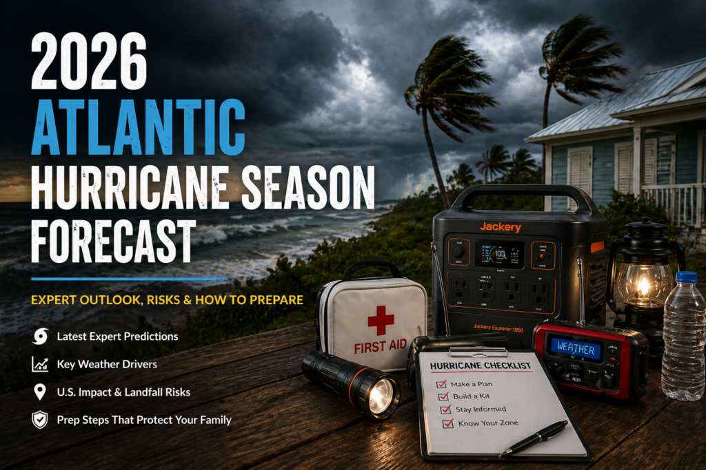
How to Prepare for the 2026 Hurricane Season Before June 1
May is the setup month. Once a named storm is on the map, the easy tasks get harder. Water shelves empty. Gas lines grow. Plywood disappears. Batteries and power banks get picked over. Insurance questions become urgent at the worst possible time.
Start with the pieces that protect your family first, then move to comfort and convenience.
Know whether you leave for storm surge, flooding, mobile-home risk, medical needs, or local evacuation orders.
Look at homeowners, renters, wind, and flood coverage. Do not wait until a storm is already being tracked.
Water, food, medications, flashlights, batteries, first aid, pet supplies, hygiene items, and printed documents should be ready early.
Use local emergency alerts, Wireless Emergency Alerts, a NOAA Weather Radio, and the National Hurricane Center for official storm information.
Decide what must stay powered: phones, medical devices, fans, refrigerator, lights, router, or small cooking tools.
Trim branches, clean gutters, check shutters, test window protection, and know where loose outdoor items will go.
For a deeper planning path, start at StormReadyHome.com, then move through your most likely weak spots. If your concern is power, review the solar emergency power guide and the gas emergency generator guide. If your household is still missing a written plan, download the checklist below and print it before the season starts.
Download the Free Storm-Ready Checklist
The forecast may be near average, but your prep should not be average. Use the checklist to walk through supplies, contacts, utility shutoffs, insurance notes, evacuation planning, and after-storm safety before a storm is already on the map.
Download the Hurricane Preparedness ChecklistPreparedness for Homeowners, Renters, and Local Businesses
Hurricane prep looks different depending on where you live and what you are responsible for. A homeowner may need shutters, tree trimming, generator placement, and roof checks. A renter may need a better communication plan, portable power, renter’s insurance, and a safe place to go if the building is vulnerable. A small business may need employee contact lists, cash handling plans, data backups, sandbags, and a reopening checklist.
For homeowners
Focus on the things that reduce damage and speed recovery. Photograph your home before the season. Store insurance documents in a waterproof folder and in a cloud backup. Walk the property after a heavy rain and see where water collects. Check gutters and downspouts. If you use a generator, review safe placement now. A gas generator should never run in a garage, porch, breezeway, or near windows because of carbon monoxide risk.
For renters
You may not control the roof, windows, or building maintenance, but you still control your plan. Know where you would go if your building loses power for several days. Keep a small blackout kit that does not take over your apartment: rechargeable lights, power banks, a weather radio, shelf-stable food, water, basic first aid, and a printed contact sheet.
For small businesses
A storm plan should not live only in one manager’s head. Keep printed vendor contacts, staff contacts, insurance details, backup power notes, and reopening steps. Decide which systems must be shut down, which equipment must be raised off the floor, and who is allowed to make reopening decisions after local officials clear roads.
For everyone
Have a communication plan that works when cell service is overloaded. Choose an out-of-area contact. Write down important numbers. Keep a paper copy with your storm kit. A phone is useful, but it is not a plan by itself.
2026 Atlantic Hurricane Season FAQ
What is the current 2026 Atlantic hurricane season forecast?
The current expert consensus points to a near-average to somewhat below-average season, with a practical core range around 12 to 15 named storms, 5 to 8 hurricanes, and 1 to 3 major hurricanes. Some forecasts are lower, while the University of Arizona forecast is much higher.
Why is El Niño important for the Atlantic hurricane season?
El Niño often increases wind shear across the Atlantic and Caribbean. Wind shear can disrupt tropical storms by tilting their circulation and pushing thunderstorms away from the center. That usually makes Atlantic hurricane development harder.
Does a below-average forecast mean my area is safe?
No. Seasonal forecasts describe basin-wide activity. They do not tell you whether your county, beach, neighborhood, or business will take a direct impact. A quiet season can still produce one destructive landfall.
What does ACE mean?
ACE stands for Accumulated Cyclone Energy. It measures the combined strength and duration of tropical storms and hurricanes across the season. A long-lived hurricane can add a lot of ACE even if the total storm count is not extreme.
When will NOAA release its official 2026 hurricane outlook?
NOAA’s official Atlantic seasonal hurricane outlook is usually released in late May, before the June 1 start of the Atlantic season. This article should be updated when that outlook is published.
Should I still buy flood insurance in a quieter forecast year?
If flooding would cause a serious financial problem for your household, review flood insurance before the season starts. Standard homeowners insurance usually does not cover flood damage, and flooding can happen outside the highest-risk zones.
Where should I get real-time storm updates?
Use the National Hurricane Center for official tropical cyclone advisories, forecast cones, storm surge information, and tropical weather outlooks. Also use your local emergency management office for evacuation decisions, shelter information, and county-specific alerts.
Final Takeaway: Prepare for the Storm, Not the Seasonal Average
The 2026 Atlantic hurricane season forecast is not screaming for a record-breaking season right now. Most expert outlooks are leaning near average to somewhat below average because El Niño is expected to build and make the Atlantic atmosphere more hostile for storm development.
Still, that is only part of the story. Warm water remains a concern in the Gulf, Caribbean, and western Atlantic. Rapid intensification is still possible. A storm that forms close to land can still give families very little time to react. And water, not just wind, remains one of the most dangerous parts of any tropical cyclone.
Use the calmer forecast as your chance to get ahead. Check your zone. Print the checklist. Review your power plan. Make sure your family can receive alerts even if the power or cell network fails. A good storm plan is usually built on a quiet day, not during the final grocery run before landfall.
Sources and References
- Colorado State University Tropical Meteorology Project. “Forecast for 2026 Hurricane Activity.” Released April 9, 2026. CSU Seasonal Hurricane Forecasting
- North Carolina State University. “2026 Hurricane Season Could See 12 to 15 Named Storms; 6 to 9 Hurricanes.” Published April 22, 2026. NC State 2026 hurricane outlook
- AccuWeather. “Atlantic hurricane season forecast 2026: 11 to 16 named storms predicted by AccuWeather.” Published March 25, 2026, updated April 9, 2026. AccuWeather 2026 hurricane forecast
- The Weather Company / Atmospheric G2. “Latest 2026 Hurricane Season Outlook From The Weather Company Indicates A Relatively Quiet Season.” Published April 16, 2026. The Weather Company 2026 outlook
- University of Arizona Department of Hydrology and Atmospheric Sciences. “Forecast of the 2026 Hurricane Activities over the North Atlantic.” Published April 3, 2026. University of Arizona forecast
- University of Pennsylvania Mann Research Group. “The 2026 North Atlantic Hurricane Season: University of Pennsylvania EES Forecast.” Published April 2026. University of Pennsylvania forecast
- NOAA Climate Prediction Center. “ENSO Diagnostic Discussion.” Issued April 9, 2026. NOAA CPC ENSO Diagnostic Discussion
- World Meteorological Organization. “WMO: Likelihood increases of El Niño.” Published April 24, 2026. WMO El Niño update
- NOAA Climate Prediction Center. “Background Information: North Atlantic Hurricane Season.” NOAA CPC hurricane season background
- Colorado State University Tropical Meteorology Project. “Atlantic Basin Seasonal Hurricane Forecast for 2026.” PDF issued April 9, 2026. CSU 2026 hurricane forecast PDF
- ECMWF. “How confident should we be in a prediction of El Niño?” Published April 10, 2026. ECMWF El Niño forecast discussion
- National Hurricane Center. “Storm Surge Overview.” NHC storm surge overview